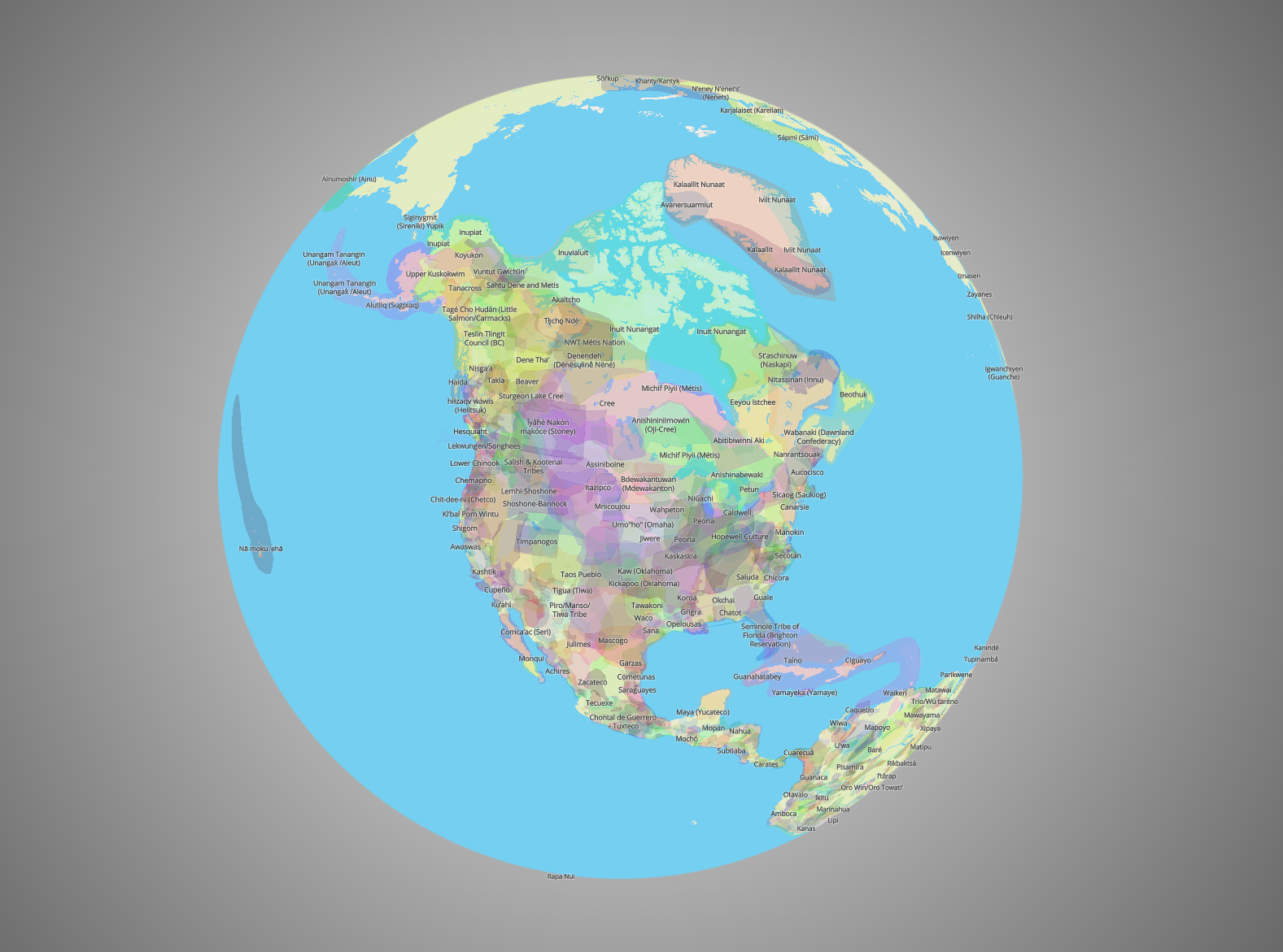
An interactive map showcasing Indigenous lands is a powerful tool that educates and raises awareness about the historical and present-day territories of Indigenous peoples. This innovative digital resource utilizes geographic data to help users understand the Indigenous territories on which they currently reside. The map provides a visual representation of the rich tapestry of Indigenous cultures and their deep connections to the land. It not only acknowledges the ancestral homelands but also highlights the ongoing struggles and resilience of Indigenous communities.
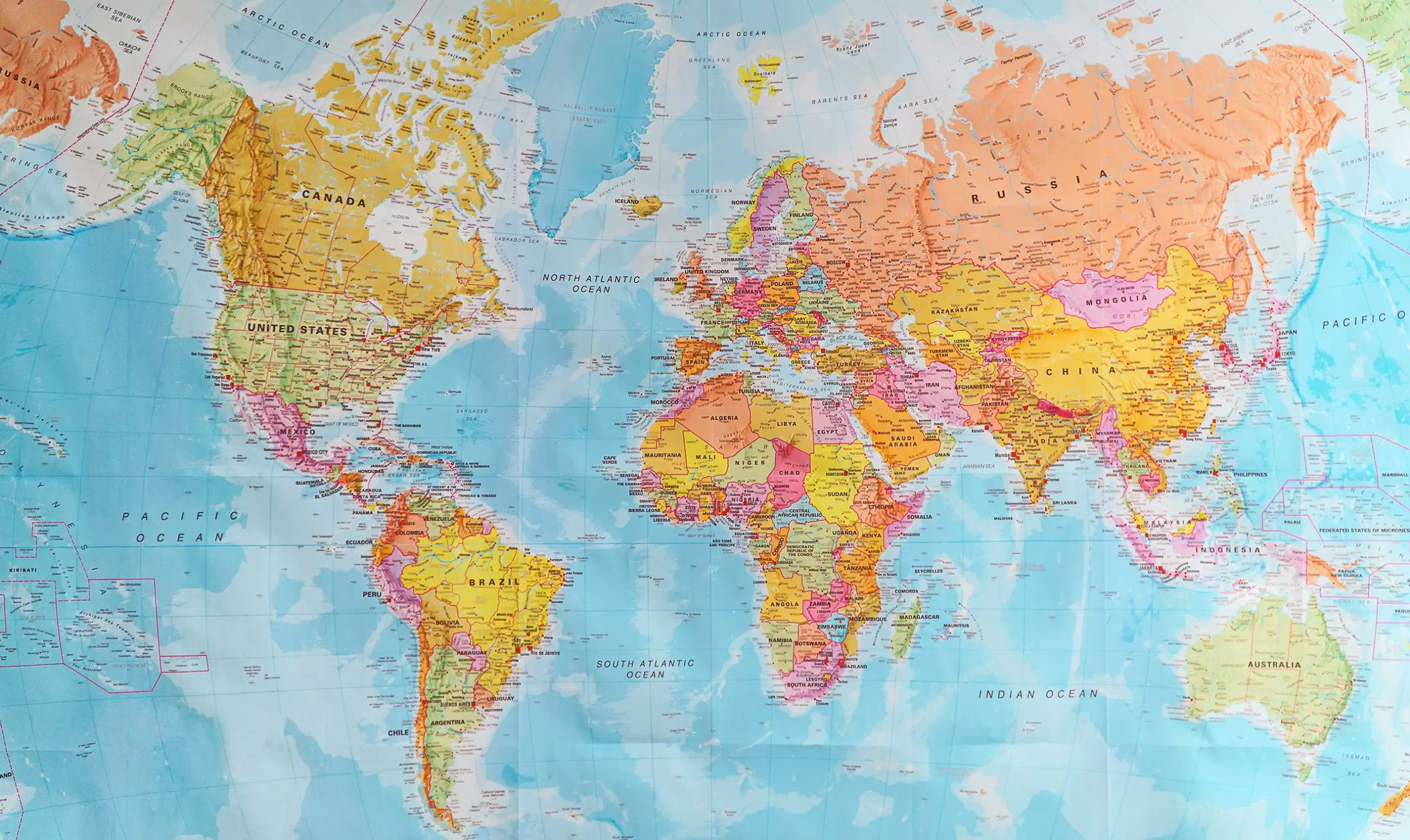
By providing information about Indigenous territories, languages, and treaties, Native Land Digital offers a comprehensive view of the cultural heritage and diversity that exists globally. The map covers regions spanning North America, Central America, South America, Africa, Australasia, Nordic Europe, and parts of Asia, highlighting the significant presence of Indigenous communities worldwide.
An Educational Resource for All
Native Land Digital goes beyond being a resource solely for Indigenous communities by offering insightful information for anyone interested in learning about the history and impact of Indigenous peoples on the land we inhabit. The interactive map enables users to engage in a powerful educational experience where they can discover the Indigenous heritage of specific locations.
Whether you’re exploring the address of an iconic landmark or discovering the Indigenous community connected to your own neighborhood, Native Land Digital encourages us all to reflect on the land we occupy and the histories that shape it.
Supporting Indigenous and Non-Indigenous Relationships
One of the core missions of Native Land Digital is to foster stronger relationships between Indigenous and non-Indigenous people. By providing accessible information about Indigenous territories, languages, and treaties, they aim to bridge gaps in knowledge and understanding. This platform empowers individuals to engage with the complex history and cultural heritage of the Indigenous peoples who have lived on the land for centuries.
Technology and Data Sources: Building an Innovative Indigenous Land Map
The development of the Interactive Map showcasing Indigenous lands involved cutting-edge technology and a diverse array of data sources. This innovative tool was crafted through the collaborative efforts of various organizations and individuals committed to raising awareness about Indigenous territories.
Technologically, the map’s creation relied on Geographic Information Systems (GIS) software, which allowed for the integration of geographical data with Indigenous land boundaries. Data from satellite imagery, topographical maps, and governmental records were used to accurately delineate these territories. Advanced mapping tools enabled the visualization of these boundaries in a user-friendly and interactive format.

Numerous organizations and individuals played a pivotal role in bringing this project to fruition. Indigenous communities and leaders contributed their invaluable local knowledge and data, ensuring the map’s accuracy and cultural sensitivity. Environmental and Indigenous rights organizations lent their expertise in data collection and advocacy, further enhancing the project’s credibility. Collaborative efforts also extended to tech-savvy developers, designers, and data scientists who worked tirelessly to create a user-friendly and visually engaging interface.
Overall, the Interactive Map showcasing Indigenous lands stands as a testament to the power of technology, data integration, and collaborative efforts in the pursuit of promoting Indigenous rights and raising awareness about their ancestral territories.
How To Explore Indigenous Lands with an Interactive Map
This valuable tool allows individuals to acknowledge the historical and cultural significance of the land they inhabit. In this step-by-step guide, we will walk you through how to access and use this interactive map.
Step 1: Visit the Website To begin, open your web browser and go to the website that hosts the interactive map. Ensure you have a stable internet connection for a seamless experience.
Step 2: Enter Your Location Once you’re on the website, you’ll typically find a search bar or a “Locate Me” button. Enter your current address, city, or region to pinpoint your location on the map.
Step 3: Explore Indigenous Territories The map will then display your location and overlay it with the Indigenous territories and lands that exist in that area. You will see various colored polygons representing different Indigenous groups.
Step 4: Click on Polygons for Information To learn more about a specific Indigenous territory, click on the corresponding polygon. A pop-up window will appear, providing information about the Indigenous community, their history, and cultural significance.
Step 5: Educate Yourself Take the time to read about the Indigenous groups and their history in the area. Explore their traditional territories, languages, and important landmarks.
Step 6: Share and Educate Others Use the information you’ve gathered to raise awareness among friends and family about the Indigenous lands you live on. Encourage others to use the interactive map as well to foster a deeper understanding of Indigenous cultures and histories.

Accessing and using the interactive map to discover the Indigenous lands you are living on is a powerful way to connect with the rich cultural heritage of the Indigenous communities in your area. By following this step-by-step guide, you can take the first steps towards greater awareness, respect, and acknowledgment of Indigenous territories.
Importance of recognizing Indigenous lands
Recognizing Indigenous lands is of paramount importance as it fosters a deeper understanding of the historical and ongoing relationships between Indigenous communities and the territories they inhabit. It is a crucial step towards acknowledging the profound injustices that Indigenous peoples have endured through colonization, dispossession, and forced displacement. Here are some key points to consider when writing about the significance of recognizing Indigenous lands:
- Acknowledging History: Recognizing Indigenous lands is a tangible way to confront the historical injustices committed against Indigenous peoples. For centuries, Indigenous communities have faced violence, displacement, and marginalization as their ancestral lands were stolen or disrupted. Acknowledgment is a small but vital step towards reconciliation.
- Promoting Respect and Understanding: Indigenous lands recognition encourages respect for the rich cultures, traditions, and knowledge systems of Indigenous peoples. It fosters cross-cultural understanding and helps bridge gaps in knowledge, leading to a more inclusive society.
- Land Stewardship: Indigenous communities often possess profound ecological knowledge and a strong connection to the land. By acknowledging Indigenous lands, we can promote sustainable land management practices that benefit both the environment and society as a whole.
- Legal and Political Implications: In some regions, recognizing Indigenous lands has legal implications, such as consultation requirements for development projects. It can also lead to the protection and restoration of Indigenous territories, helping to preserve biodiversity and combat climate change.
- Supporting Indigenous Rights: Acknowledgment of Indigenous lands is an essential aspect of upholding Indigenous rights, including land rights, self-determination, and cultural preservation. It can empower Indigenous communities to assert their sovereignty and protect their heritage.
- Fostering Reconciliation: Reconciliation between Indigenous and non-Indigenous peoples is an ongoing process. Recognizing Indigenous lands is a symbolic gesture that contributes to healing historical wounds and building stronger relationships based on mutual respect and understanding.
Recognizing Indigenous lands is not only a symbolic act but a practical step towards justice, respect, and reconciliation. It highlights the importance of Indigenous perspectives and contributions to our shared society, and it is a reminder of the responsibilities we all share in caring for the lands we inhabit. Ultimately, acknowledging Indigenous lands helps pave the way for a more inclusive and equitable future.
Embracing Indigenous Heritage
Native Land Digital’s interactive map is a game-changer when it comes to promoting awareness of Indigenous territories and cultures. It enables us to acknowledge and celebrate the historical and sacred ties to the land, encouraging a more inclusive and respectful approach to our surroundings.
So let’s take a moment to explore the map and embrace the Indigenous heritage that exists all around us. By doing so, we can contribute to a world where the knowledge and experiences of Indigenous peoples are appreciated, respected, and honored.
Sources:
Peoples under threat around the world: Interactive Map
Native Land Digital
Which Indigenous lands are you on?

This Site Was Inspired By An Interest in Protecting the Environment:
We had the privilege and joy of learning from Dr. Charlie Stine who instilled a love for the natural world through incredible field trips with the Johns Hopkins Odyssey Certificate program in Environmental Studies. At the time, the program was endorsed by the Maryland Department of Natural Resources. Sadly, after Dr. Stine retired, the program was phased out. We hope that we honor his legacy by shining a bright light on environmental issues and sharing good news about the success of various conservation programs when possible.
